
Products / iAgro-GeoTag
iAgro-GeoTag
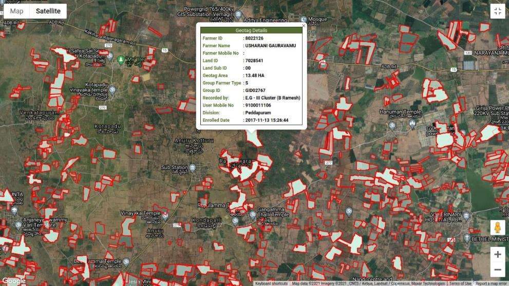
Every garden boundary, drawn and stored against a farmer.
India's first crop management geo-tagging CRM. It captures geo-tagged land parcels under commercial crops, periodical field data with images and video, farmer complaints, field-staff movement and rich geocoded MIS reports with thematic maps.
- First in Indiacrop geo-tagging CRM
- Photo, video, audioevidence from the field
- Satellite viewwhole estates for district officers
What it does
- Every garden boundary drawn and stored against a farmer ID, survey number and division
- Complaint lifecycle (raise, review, resolve) with photographs and audio from the field
- Satellite map view of an entire plantation estate for the district officer
- Field-staff movement tracking and geocoded MIS reports with thematic maps
Two workflows in one field app
- Field staff login & farmer selectionSelect or register the farmer; verify farmer ID and mobile number
- GPS land boundary geo-taggingWalk or mark the parcel; auto-capture the GPS polygon; record area and sub-ID
- Crop & plantation data captureCrop boundaries, variety, irrigation and fertiliser records, photos, video, audio
- Sync to central serverGeocoded MIS database updated; farmer and group records linked
- Thematic maps & MIS reportsPlantation on satellite map; cluster and division-wise views
- Farmer raises a complaintLogged by field staff, linked to farmer ID and land parcel
- Supporting evidence capturedPhotos, video, audio; ticket ID, timestamp and GPS tag generated
- Routed to manager dashboardGrouped under Under Review with farmer and location detail
- Manager reviews & actsInspects evidence, coordinates advisory, marks Reviewed
- Feedback & history reportResolution shared back; history retained per farmer; feeds MIS
In the field and on the map
Where it runs
- Oil palm cooperatives and enterprises using iPalm: iAgro-GeoTag is the field-audit app inside the iPalm ERP
Let's put this in front of your state and districts.
Book an in-person presentation, a live demonstration on your own data, a technical briefing with your IT team, or an RFP/RFQ consultation.